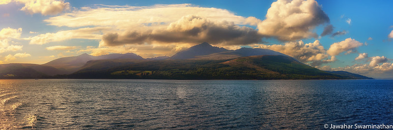
Off the west coast of Scotland Arran, in the Firth of Clyde is Scotlands 6th largest island. Accessible by a regular ferry service from Saltcoats, the island is divided into highland and lowland areas and has been described as a “geologist’s paradise” (Source: Wikipedia).
Arran is the largest island in the Firth of Clyde and the seventh largest in Scotland. The King’s Caves are a series of natural caves on the western shores of Arran and are associated with Robert the Bruce of Scotland. Legend has it that he took refuge in these caves while on the run and had his famous encounter with the spider. For more on this legend see here.
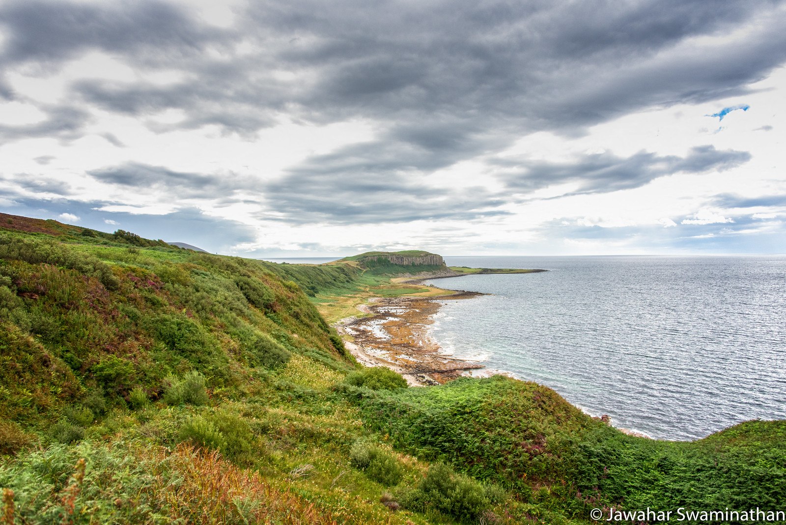
The following photograph was taken on a hike to the King’s caves and shows the Doon in the distance. The Doon is a geological formation known as sill – which is formed when magma extrudes through older rocks and solidifies. The Doon seen in this picture is formed of sheer vertical columns of rock.
View of the Doon and the western shore of Arran (Click here to see a larger version on Flickr)
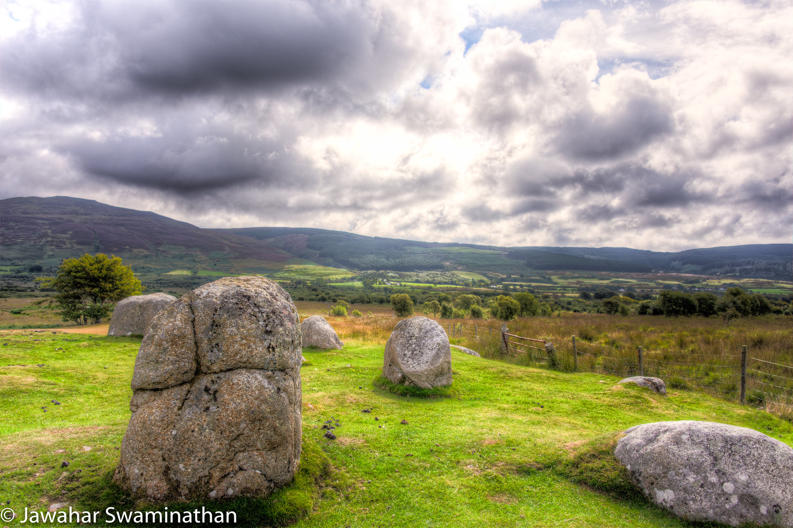
The Machrie Moor stone circles are a collection of 6 stone circles that date back to the neolithic and bronze age in the island of Arran in Scotland. A short walk (1 mile) through a footpath through a working farm gets you to the moor where these stone circles can be found. The photos below are of Machrie Moor stone circle 1, which is formed of 6 granite boulders and alternating 4 sandstone slabs.
The scenery around the moor is breathtaking and it was one of the high points of my visit to Arran.
Technical Details:
Shot with a Nikon D750 with a 28-300 Nikon Lens. All photographs are from 3-bracketed exposures and processed in Photomatix Pro.
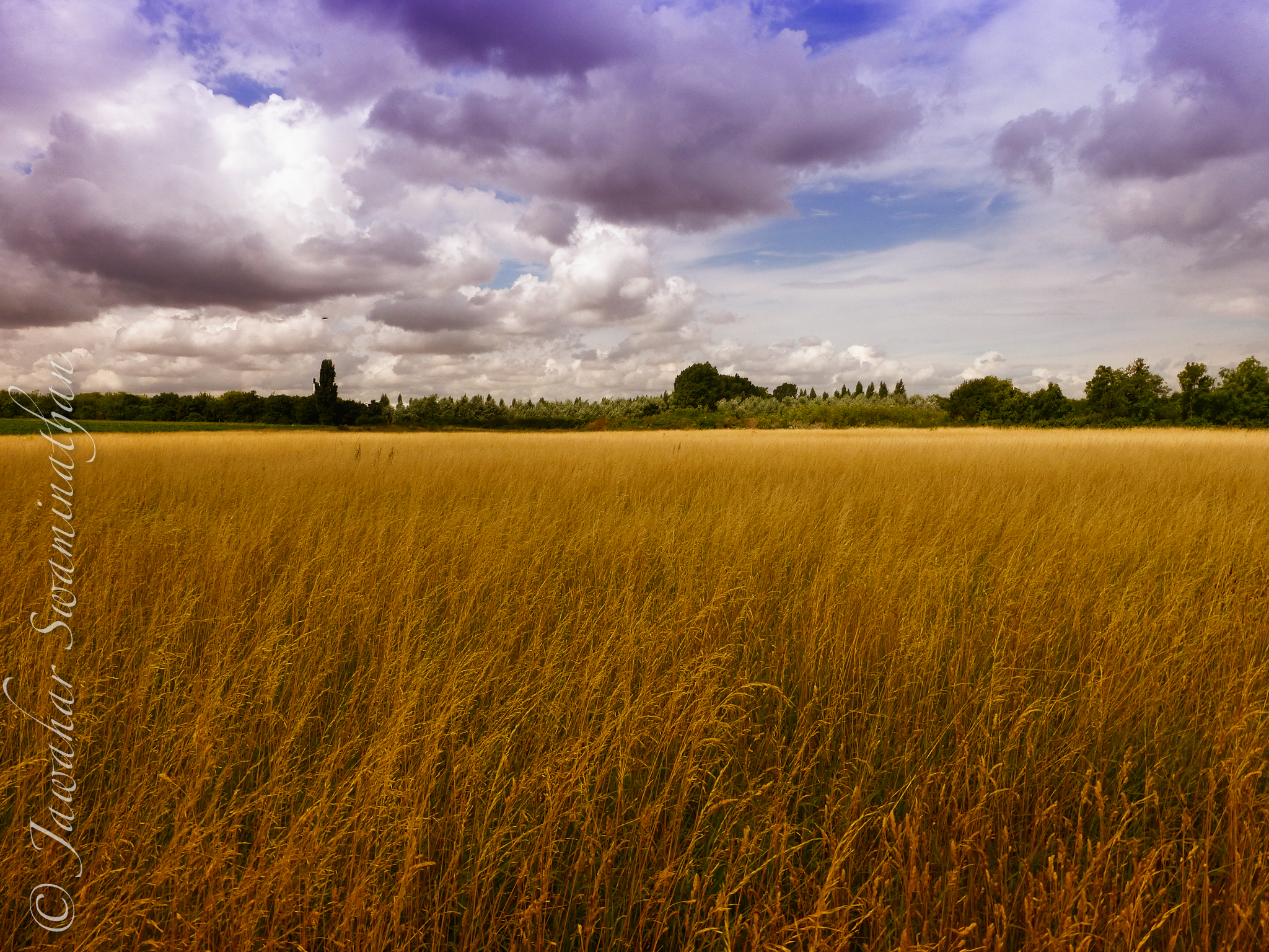
At the Queensmead Lake in Staines, England. A tranquil place to relax and walk, yet within 5 minutes walking distance from Staines town centre. 3-shot bracketed HDR processed in NIK HDREfex Pro